
Plik:Arlington National Cemetery map - 2013.jpg
Rozmiar pierwotny (1318 × 1576 pikseli, rozmiar pliku: 1,52 MB, typ MIME: image/jpeg)
| Plik Arlington National Cemetery map - 2013.jpg znajduje się w Wikimedia Commons – repozytorium wolnych zasobów. Dane z jego strony opisu znajdują się poniżej. |
Opis
| Opis |
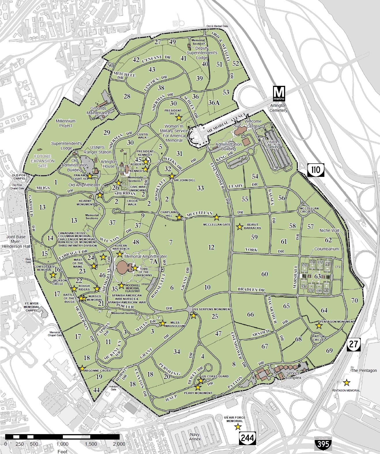
English: Map of Arlington National Cemetery in Arlington County, Virginia, in the United States. Numbers on the map indicate the various sections in the cemetery.
Important buldings, graves, memorials, and monuments are denoted by gold stars on the map, and may be found thus (section number first, then the name of the grave, structure, or memorial): |
| Data | |
| Źródło | http://www.arlingtoncemetery.mil/Map/ANCExplorer.aspx |
| Autor | US Army |
Licencja
Ta grafika została utworzona przez pracownika lub żołnierza Armii Stanów Zjednoczonych podczas wykonywania czynności służbowych. Jako utwór Rządu Federalnego Stanów Zjednoczonych, grafika ta znajduje się w domenie publicznej.
|
 |
Historia pliku
Kliknij na datę/czas, aby zobaczyć, jak plik wyglądał w tym czasie.
| Data i czas | Miniatura | Wymiary | Użytkownik | Opis | |
|---|---|---|---|---|---|
| aktualny | 22:12, 25 kwi 2013 | | 1318 × 1576 (1,52 MB) | Tim1965 | {{Information |Description ={{en|1=Map of Arlington National Cemetery in Arlington County, Virginia, in the United States.}} |Source =http://www.arlingtoncemetery.mil/Map/ANCExplorer.aspx |Author =US Army |Date =2013 |Permi... |
Lokalne wykorzystanie pliku
Poniższa strona korzysta z tego pliku:
Globalne wykorzystanie pliku
Ten plik jest wykorzystywany także w innych projektach wiki:
- Wykorzystanie na rue.wikipedia.org