
Plik:USACE Mansfield Hollow Lake.jpg
Rozmiar podglądu – 748 × 600 pikseli. Inne rozdzielczości: 299 × 240 pikseli | 599 × 480 pikseli | 958 × 768 pikseli | 1277 × 1024 pikseli | 1500 × 1203 pikseli.
Rozmiar pierwotny (1500 × 1203 pikseli, rozmiar pliku: 1,53 MB, typ MIME: image/jpeg)
| Plik USACE Mansfield Hollow Lake.jpg znajduje się w Wikimedia Commons – repozytorium wolnych zasobów. Dane z jego strony opisu znajdują się poniżej. |
|
To jest zdjęcie miejsca lub budynku wpisanego na listę Narodowego Rejestru Miejsc Historycznych w Stanach Zjednoczonych pod numerem 3000194. |
| Opis |
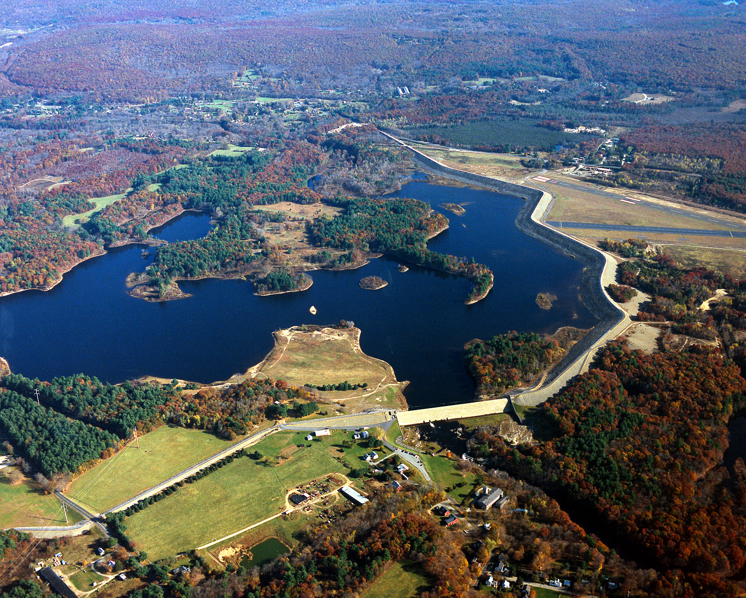
English: Mansfield Hollow Lake in Tolland County, Mansfield, Connecticut, USA. The U.S. Army Corps of Engineers constructed the dam as a flood control measure. It impounds the waters of the Fenton, Mount Hope, and Natchaug Rivers. |
|||
| Data | 10 kwietnia 1999 (Date as given in the description, but the date seems unlikely given the autumn color in the landscape.) | |||
| Źródło |
U.S. Army Corps of Engineers Digital Visual Library Image page Image description page Digital Visual Library home page |
|||
| Autor | U.S. Army Corps of Engineers, photographer not specified or unknown | |||
| Licencja (Ponowne użycie tego pliku) |
|
| Pozycja fotografa | | To i inne zdjęcia na: OpenStreetMap |
|---|
Historia pliku
Kliknij na datę/czas, aby zobaczyć, jak plik wyglądał w tym czasie.
| Data i czas | Miniatura | Wymiary | Użytkownik | Opis | |
|---|---|---|---|---|---|
| aktualny | 07:04, 4 cze 2007 | | 1500 × 1203 (1,53 MB) | Grendelkhan | {{Information | Description = {{en|Mansfield Hollow Lake in Windham County, Connecticut, USA. The U.S. Army Corps of Engineers constructed the dam as a flood control measure. It impounds the waters of the Natchaug River.}} | Source = U.S. Army |
Lokalne wykorzystanie pliku
Poniższa strona korzysta z tego pliku:
Globalne wykorzystanie pliku
Ten plik jest wykorzystywany także w innych projektach wiki:
- Wykorzystanie na ceb.wikipedia.org
- Wykorzystanie na de.wikipedia.org
- Wykorzystanie na en.wikipedia.org
- Mansfield, Connecticut
- List of Connecticut state parks
- National Register of Historic Places listings in Tolland County, Connecticut
- National Register of Historic Places listings in Windham County, Connecticut
- Mansfield Hollow Lake
- Portal:Geography/Featured picture/2007, week 40
- Portal:Geography/Featured picture archive/2007
- Wikipedia:WikiProject Lakes/Galleries/11
- Mansfield Hollow State Park
- Wykorzystanie na fa.wikipedia.org
- Wykorzystanie na sv.wikipedia.org
- Wykorzystanie na www.wikidata.org