
Plik:Passarowitz 1718.JPG
Rozmiar pierwotny (1200 × 1681 pikseli, rozmiar pliku: 977 KB, typ MIME: image/jpeg)
| Plik Passarowitz 1718.JPG znajduje się w Wikimedia Commons – repozytorium wolnych zasobów. Dane z jego strony opisu znajdują się poniżej. |
Opis
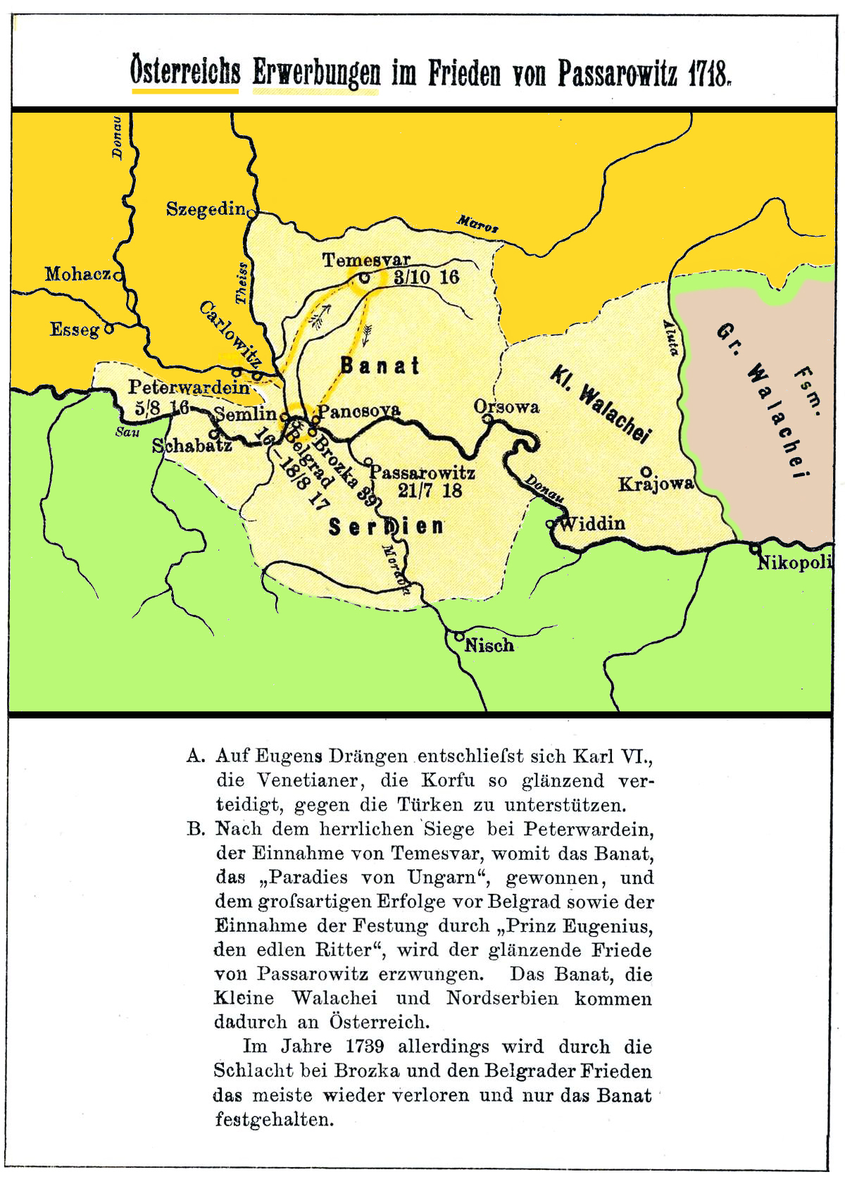
I scanned the map. Source: Karten und Skizzen aus der vaterländischen Geschichte der Neueren Zeit (1517-1789). III. Band des "Historischen Kartenwerkes" Düsseldorf. 5. Auflage, 1900.
Licencja
|
Ten materiał przeszedł do domeny publicznej w kraju pochodzenia, jak również w państwach i terytoriach, gdzie prawo autorskie wygasa w ciągu 70 lat po śmierci autora.
| |
| Plik rozpoznano jako wolny od znanych ograniczeń praw autorskich, włącznie z prawami zależnymi i pokrewnymi. | |
Historia pliku
Kliknij na datę/czas, aby zobaczyć, jak plik wyglądał w tym czasie.
| Data i czas | Miniatura | Wymiary | Użytkownik | Opis | |
|---|---|---|---|---|---|
| aktualny | 13:12, 3 maj 2014 | | 1200 × 1681 (977 KB) | Spiridon Ion Cepleanu | Better contrast |
| 13:03, 3 maj 2014 |  | 1200 × 1681 (971 KB) | Spiridon Ion Cepleanu | Cosmetic change (coloured) | |
| 14:43, 11 gru 2009 |  | 1200 × 2073 (309 KB) | Alex:D | whitened | |
| 14:40, 11 gru 2009 |  | 1200 × 2073 (320 KB) | Alex:D | whitened | |
| 12:50, 5 kwi 2007 |  | 1200 × 2073 (320 KB) | Olahus | I scanned the map. Source: ''Karten und Skizzen aus der vaterländischen Geschichte der Neueren Zeit (1517-1789). III. Band des "Historischen Kartenwerkes" Düsseldorf.'' 5. Auflage, 1900. == Licensing == {{PD-old}} Category:Maps in German |
Lokalne wykorzystanie pliku
Poniższa strona korzysta z tego pliku:
Globalne wykorzystanie pliku
Ten plik jest wykorzystywany także w innych projektach wiki:
- Wykorzystanie na als.wikipedia.org
- Wykorzystanie na de.wikipedia.org
- Wykorzystanie na en.wikipedia.org
- Wykorzystanie na es.wikipedia.org
- Wykorzystanie na fa.wikipedia.org
- Wykorzystanie na fr.wikipedia.org
- Wykorzystanie na hu.wikipedia.org
- Wykorzystanie na it.wikipedia.org
- Wykorzystanie na nn.wikipedia.org
- Wykorzystanie na ro.wikipedia.org
- Wykorzystanie na sh.wikipedia.org
- Wykorzystanie na sr.wikipedia.org