
Plik:Vistula River Flooding, Southeastern Poland.JPG
Rozmiar podglądu – 800 × 530 pikseli. Inne rozdzielczości: 320 × 212 pikseli | 640 × 424 pikseli | 1024 × 679 pikseli | 1280 × 848 pikseli | 2560 × 1697 pikseli | 4256 × 2821 pikseli.
Rozmiar pierwotny (4256 × 2821 pikseli, rozmiar pliku: 8,87 MB, typ MIME: image/jpeg)
| Plik Vistula River Flooding, Southeastern Poland.JPG znajduje się w Wikimedia Commons – repozytorium wolnych zasobów. Dane z jego strony opisu znajdują się poniżej. |
Opis
| Opis |
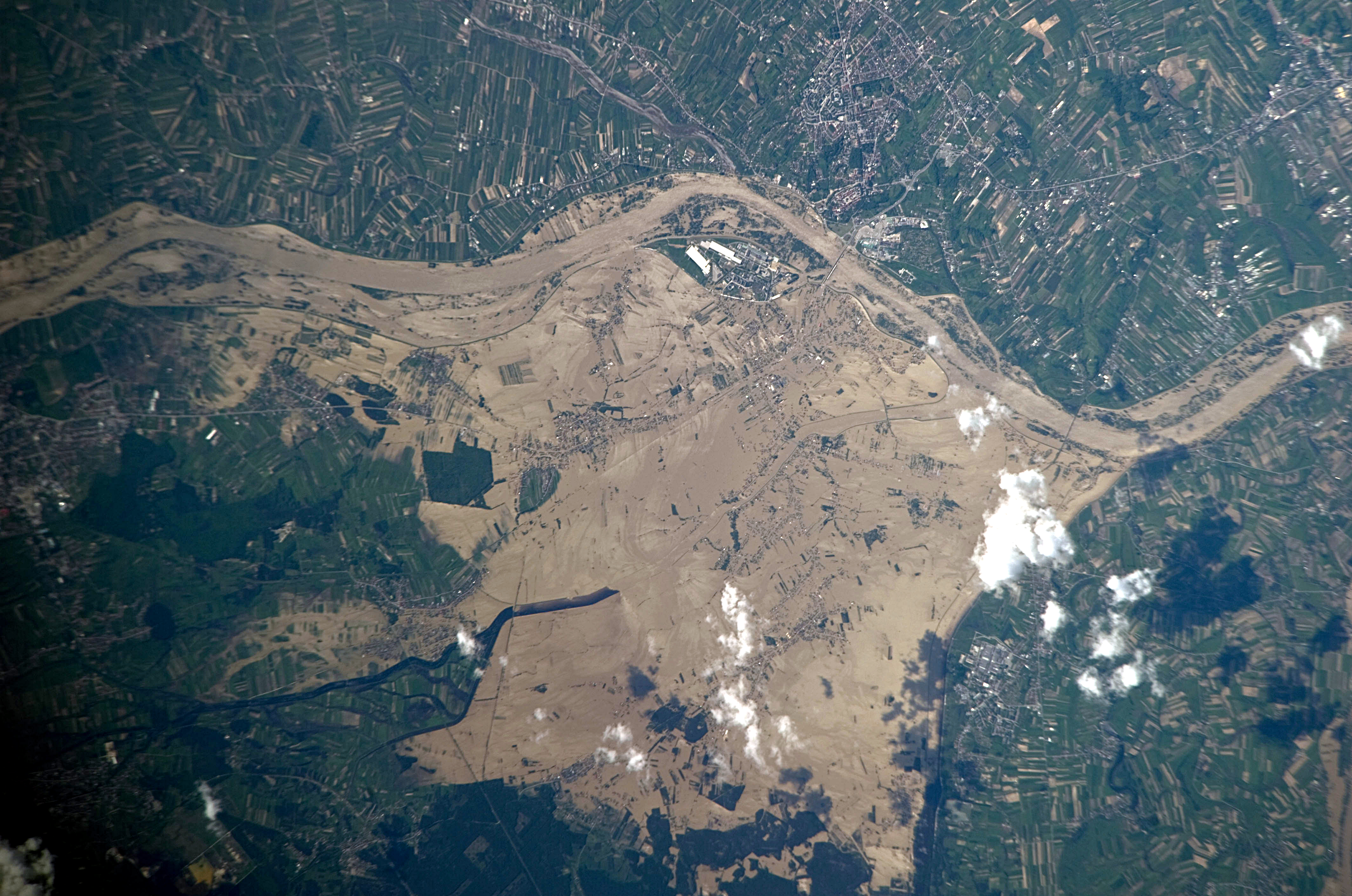
English: This image, taken by astronauts on-board the International Space Station, shows widespread flooding along the Vistula River in south-eastern Poland near Sandomierz. Several towns have been completely or partially inundated including Gorzyce, Sokolniki, and Trześń in addition to large numbers of agricultural fields (normally green as visible at image top and bottom right). |
| Data | |
| Źródło | NASA Earth Observatory |
| Autor | The NASA Expedition 23 crew |
Ta grafika lub film został skatalagowany przez Johnson Space Center Stanów Zjednoczonych Ameryki National Aeronautics and Space Administration (NASA)pod Photo ID: ISS023-E-50542. Ten szablon nie wskazuje stanu prawnego pliku. Standardowy szablon licencji jest nadal wymagany. Aby dowiedzieć się więcej, zajrzyj na stronę Commons:Licencja. Inne języki:
|
Image acquired with a Nikon D3S digital camera using an 800 mm lens, and is provided by the ISS Crew Earth Observations experiment and Image Science & Analysis Laboratory, Johnson Space Center.
Licencja
| Ten plik jest w domenie publicznej ponieważ został stworzony przez NASA. Polityka praw autorskich NASA stwierdza, że „materiały NASA nie są chronione prawami autorskimi, chyba że zapisano inaczej”. (NASA copyright policy lub JPL Image Use Policy). | ||
 |
Uwaga:
|
| Adnotacje | To zdjęcie jest opatrzone adnotacją: Zobacz adnotacje w Commons |
Historia pliku
Kliknij na datę/czas, aby zobaczyć, jak plik wyglądał w tym czasie.
| Data i czas | Miniatura | Wymiary | Użytkownik | Opis | |
|---|---|---|---|---|---|
| aktualny | 12:30, 28 maj 2010 | | 4256 × 2821 (8,87 MB) | Originalwana | {{Information |Description={{en|1=This image, taken by astronauts on-board the International Space Station, shows widespread flooding along the Vistula River in south-eastern Poland. Several towns have been completely or partially inundated includ |
Lokalne wykorzystanie pliku
Następujące strony korzystają z tego pliku:
Globalne wykorzystanie pliku
Ten plik jest wykorzystywany także w innych projektach wiki: