
Plik:Whashton - geograph.org.uk - 1626128.jpg
Rozmiar pierwotny (427 × 640 pikseli, rozmiar pliku: 272 KB, typ MIME: image/jpeg)
| Plik Whashton - geograph.org.uk - 1626128.jpg znajduje się w Wikimedia Commons – repozytorium wolnych zasobów. Dane z jego strony opisu znajdują się poniżej. |
Opis
| Opis |
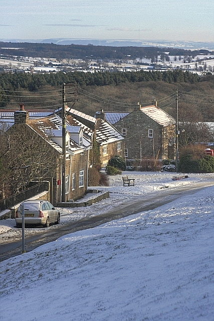
English: Whashton The following is quoted from the communigate website http://www.communigate.co.uk/ne/whashton/index.phtml
"Whashton is the site of an ancient settlement, although it is not mentioned by name in the Domesday Book of 1086 as at that time it was included with Ravensworth. "The earliest record of the village's name appears to have been 1154 when it was known as Whasingatun. This evolved through Whassingetun to Wassington by 1208. By the end of that century it had become Quasshyngton or Quassingheton and by the 16th and 17th centuries it had become the more recognisable name of Whasheton. "It is believed that the name derived from the Angles who originated in Schleswig-Holstein and who started coming to Britain after the departure of the Romans in the 5th century. The name probably derives from the Angle term for a hamlet (tun-ton) of the people (-ing) of Hwassa. "It is recorded that Akery Fitz Bardolf gave the manor of Whashton to his son Bonde fil Ajery, alias Bonde de Wassington or Bonde de Ravensworth in 1156. At one time in the 13th century half the manor was held by Henry Fitz Ranulf and the other by his under-lord, Robert, son and heir of eudo de Wassington, a descendant of Bonde. However on the death of Robert in 1286 without an heir the two halves were reunited, since when they have followed the descent of the manor of Ravensworth. "Whashton can claim to have been the site of one of the earliest boarding schools in the area. These schools drew their pupils through advertisements in the London and provincial newspapers, and flourished until being publicised by Charles Dickens in the 19th century, the so-called 'Bluecoats Schools'. The first of these schools was founded at some time in the early 18th century by a Mr Allen who died in 1749. Another school was run by Rev Henry Hale in the early 1800s, and in 1840 records show a school run by a Mrs Binks. Few details are known of the activities of these schools or if they were connected in any way. "However, the last school in Whashton was that run by Mr Thomas Waller at Whashton Lodge from about 1840 until his death in 1840. School activities were centred around a barn like building which stood to the front and west of the existing house in the grassed area adjacent to the present day pub car park. One fact worthy of note is that one of he ushers who worked for Mr Waller for a time was a Mr Hislop who had previously worked as assistant to William Shaw then headmaster of Bowes Academy at the time Charles Dickens attempted to inspect that school in 1838. The character of Wackford Squires in 'Nicholas Nickelby' is said to be based on Shaw. Hislop worked at Whashton for 10 years and died in the Hospital of St John at Kirkby Hill" In the very distance can be seen Bilsdale mast (SE5596) 40km away. |
| Data | |
| Źródło | From geograph.org.uk |
| Autor | Mick Garratt |
| Uznanie autorstwa (wymagana przez licencję) | Mick Garratt / Whashton / |
| Pozycja fotografa | | To i inne zdjęcia na: OpenStreetMap |
|---|
_heading:90.00&language=pl)
| Pozycja obiektu | | To i inne zdjęcia na: OpenStreetMap |
|---|
_heading:90.00&language=pl)
Licencja

|
Ta grafika pochodzi z kolekcji projektu Geograph. Aby zobaczyć szczegóły możesz odwiedzić stronę tego zdjęcia w serwisie Geograph. Prawa autorskie do tej grafiki posiada Mick Garratt i jest ona udostępniona na licencji Creative Commons Uznanie autorstwa – Na tych samych warunkach 2.0.
|
- Wolno:
- dzielić się – kopiować, rozpowszechniać, odtwarzać i wykonywać utwór
- modyfikować – tworzyć utwory zależne
- Na następujących warunkach:
- uznanie autorstwa – musisz określić autorstwo utworu, podać link do licencji, a także wskazać czy utwór został zmieniony. Możesz to zrobić w każdy rozsądny sposób, o ile nie będzie to sugerować, że licencjodawca popiera Ciebie lub Twoje użycie utworu.
- na tych samych warunkach – Jeśli zmienia się lub przekształca niniejszy utwór, lub tworzy inny na jego podstawie, można rozpowszechniać powstały w ten sposób nowy utwór tylko na podstawie tej samej lub podobnej licencji.
Historia pliku
Kliknij na datę/czas, aby zobaczyć, jak plik wyglądał w tym czasie.
| Data i czas | Miniatura | Wymiary | Użytkownik | Opis | |
|---|---|---|---|---|---|
| aktualny | 16:54, 4 mar 2011 | | 427 × 640 (272 KB) | GeographBot | == {{int:filedesc}} == {{Information |description={{en|1=Whashton The following is quoted from the communigate website http://www.communigate.co.uk/ne/whashton/index.phtml "Whashton is the site of an ancient settlement, although it is not mentioned by |
Lokalne wykorzystanie pliku
Poniższa strona korzysta z tego pliku:
Globalne wykorzystanie pliku
Ten plik jest wykorzystywany także w innych projektach wiki: