
Grantville (Kansas)
Na mapach:  39°05′00″N 95°33′41″W/39,083333 -95,561389
| CDP | |
| Przydomek: Kaw City[1] | |
| Państwo | |
|---|---|
| Stan | |
| Hrabstwo | |
| Wysokość |
267 m n.p.m. |
| Populacja (201) • liczba ludności |
|
| Kod pocztowy |
66429 |
Położenie na mapie Kansas 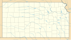 | |
Położenie na mapie Stanów Zjednoczonych  | |
Grantville CDP w Hrabstwie Jefferson w stanie Kansas.
Przypisy[edytuj | edytuj kod]
- ↑ GNIS Detail - Grantville [online], geonames.usgs.gov [dostęp 2017-11-18] (ang.).
- ↑ Grantville, Kansas (KS 66429, 66617) profile: population, maps, real estate, averages, homes, statistics, relocation, travel, jobs, hospitals, schools, crime, moving, houses, ... [online], www.city-data.com [dostęp 2017-11-18] (ang.).